Impact story
Natural water storage in a subtropical delta
As the world, continues to urbanize, sustainable development challenges will be increasingly concentrated in cities. Over 90% of all urbanisation in 2030, will occur in the developing world. Natural disasters, such as flooding and heat stress, often effects the lives of the poor the most. Therefore, measures need to be taken to deal with these challenges. However, urban growth together with underdeveloped infrastructure (e.g. the lack of sewerage, water retention and infiltration areas and flood protection) threatens sustainable development of these areas.
Motivation
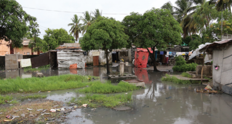
Beira is a coastal city in the delta, at which the Buzi and Pungwe Rivers meet the Indian Ocean. Beira is one of the fastest growing economic centres in Mozambique. Beira was established in 1890 by Portugal. When the Portuguese left Mozambique in 1975, the City attracted inhabitants from the rural surroundings. Beira’s population is currently over 500,000 and is growing fast. The less wealthy live in slums. The richer built their homes on mounds, for which they use sand from coastal dunes, thereby reducing the natural protection from floods. Many homes are not connected the sewerage but use cesspits instead. The City floods during heavy rains and storms. The water remains in the lowest areas of the City for weeks. Families that normally sleep on the floor seek refuge on their tables. The contents of the cesspits are spilled all over. The contaminated standing water is a source of diseases and excessive mosquito outbreaks.
Solution
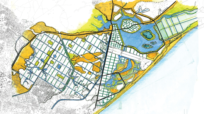
Scientists mapped Beira’s infrastructure and land-use in detail. Recent satellite images were used to identify areas where water flows in first and flooding lasts longest. These maps formed basic input for local stakeholder workshops. In cooperation with civil servants from the municipality and inhabitant representatives', spatial strategies to cope with excessive rainfall in areas of concern were developed. Spatial strategies focused on grey infrastructural measures and nature-based solutions, including the location of hotspots for water infiltration and retention, 'green-infrastructure' to slow down the rainwater discharge by absorbing part of it, and the design of a canal and sewerage network. The costs and effects of these measures in heavy rain were calculated to further refine the spatial plan.
Wageningen University & Research carried out these activities in cooperation with: Deltares, Witteveen&Bos, Wissing Urban Design, FloodConsult and Universidade Católica de Moçambique.
Local stakeholders share the sense of urgency needed to implement the measures in the near future
Impact and future perspective
These spatial strategies are a first and crucial step in solving the flooding problems. It now is clear what measures should be taken, the locations that need to be tackled and the costs involved. Furthermore, local stakeholders share the sense of urgency to implement the measures in the near future. However, the challenge to find donors and funds for the organisation and implementation of the measures remains.
