
Project
An Earth Observation framework for soil carbon sequestration monitoring (EO4CSM)
Within the ESA project EO4CSM we are developing and validating a methodology, which can improve the national monitoring of carbon sequestration of agricultural soils. The methodology is based on a dynamic carbon turnover model RothC (Rothamsted Carbon model) that will be coupled with Earth Observation (EO) data. The EO-data provides accurate and realistic information on vegetation cover, crop status and crop management practices (further denoted as grassland and cropland indicators) at parcel level.

The methodology exploits the strengths of both the RothC model and the EO-data:
- The RothC carbon model is relatively simple, easy to use and requires little input data, is widely used and scientifically acknowledged.
- The grassland and cropland indicators at parcel level are simple indicators and relatively easy to derive from high-resolution satellite imagery (Sentinel-1 and 2), BUT are highly relevant for the monitoring of carbon sequestration, which includes:
- monthly vegetation cover of main AND cover crop (2nd crop or catch crop);
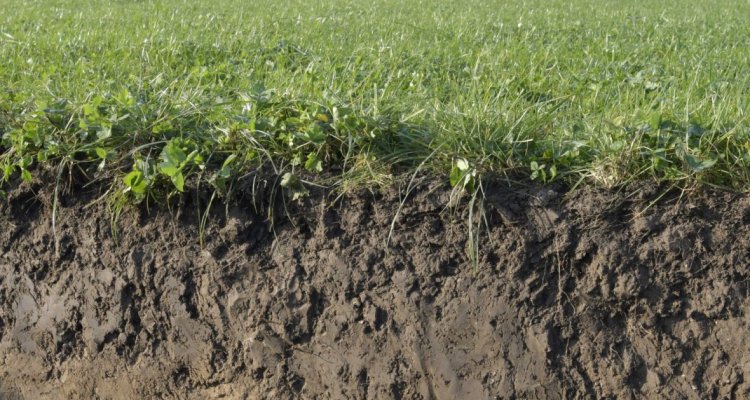
- grassland renewal activities (where the old grassland layer is destroyed and the parcel is reseeded);
- crop production information at parcel level. Here we will use a simple crop growth model (LINTULL) to model crop production (and crop residuals) at parcel level, where the model will be forced with fAPAR time series, crop emergence and harvest dates (of main and cover crop) based on Sentinel-2.
The EO-based grassland and cropland indicators provide realistic and more accurate information and at a higher resolution than most of the (sub)national statistics currently used in the national carbon monitoring strategies. Together, the RothC model and EO-data make it possible to monitor at parcel level and at a national scale.
It will be investigated if the model accuracy of RothC will improve once it’s fed with these newly proposed EO-based grassland and cropland indicators. This will be done by performing a number of RothC simulations, covering the period 2018-2024 for the whole of the Netherlands, with varying spatial resolution (i.e. at postal code level for ~3400 units and parcel level for ~500.000 parcels). The RothC simulations will be validated against soil C-measurements that have been and will be collected in ~100 parcels (in the period 2018-2024).
This project is carried out by Wouter Meijninger, Jan Peter Lesschen, Chantal Hendriks, Allard de Wit, Gerbert Roerink and Johnny te Roller (Teams: Earth Observation and Environmental Informatics & Sustainable Soil Management)
More information of the EO4CSM project the results for 2022 can be found here.