Maps
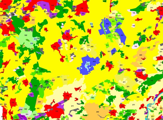
Land Cover in the Netherlands for 2012 according to European CORINE standard
CLC2006, CLC2012 and the CLC-changes2006-2012 land cover databases are available for the Netherlands. Also detailed layers representing artificial surfaces, forest areas (tree cover density and forest type), permanent grasslands, wetlands and small water bodies were produced for the Dutch territory. The production of those products was possible with funding from the Union in the context of the Copernicus programme.
CLC2012
Corine Land Cover is a unique database covering 39 countries in Europe making comparison between countries possible regarding their land cover and the changes in land cover for more than 20 years.
The Corine Land Cover inventory was initiated in 1985 (reference year 1990). Updates have been produced in 2000 and 2006, and the latest 2012 update is under production. The Netherlands was involved since the beginning. In most of the European countries updating has been done by visual interpretation of the satellite images. It consists of an inventory of land cover in 44 classes. CLC uses a Minimum Mapping Unit (MMU) of 25 ha for areal phenomena and a minimum width of 100 m for linear phenomena. The time series are complemented by change layers, which highlight changes in land cover with an MMU of 5 ha. CLC is produced by visual interpretation of high resolution satellite imagery.
CLC has a wide variety of applications, underpinning various Community policies in the domains of environment, but also agriculture, transport, spatial planning etc…

High Resolution Layers
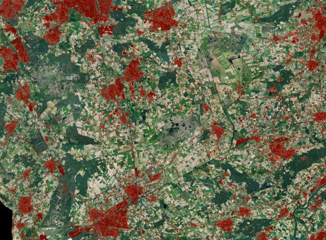
Pan-European High Resolution Layers (HRL) provide information on specific land cover characteristics, and are complementary to land cover / land use mapping such as in the Corine land cover (CLC) datasets. The HRLs are produced from 20 m resolution satellite imagery through a combination of automatic processing and interactive rule based classification.
Five HRL layers, i.e. artificial surfaces (sealed soil i.e. imperviousness), forest areas (tree cover density and forest type), agricultural areas (permanent grasslands), wetlands and small water bodies are being produced as a part of the project. Pixels of 20 by 20 m are regrouped into 100 by 100 m grid cells for final products.
The layers will cover the 39 European countries and are produced by service providers for EEA. Please note that the High Resolution Layers are currently in production and as such, do not have full European coverage and have not yet undergone verification, enhancement and validation.
The HRLs can then be used, for example, as attributes for different kind of map objects, such as NUTS3, CLC polygons, regular grids or designated areas.

Additional background information:
- Hazeu, G.W., 2003. CLC2000 Land Cover database of the Netherlands. Monitoring land cover changes between 1986 and 2000. Wageningen, Alterra, Green World Research. Alterra-rapport 775 / CGI-rapport 03-006, 108 pp., 12 figs, 11 tables, 16 refs.
- Feranec, J., Hazeu, G.W., Christensen, S. & Jaffrain G., 2007. CORINE Land Cover change detection in Europe (Case studies of the Netherlands and Slovakia). Land Use Policy 24, 234-247.
- Feranec, J., Hazeu, G.W., Cebecauer, T. & Jaffrain, G., 2007. Cartographic aspects of land cover change detection (over- and underestimation in the I& CORINE Land Cover 2000 Project). The Cartographic Journal 44(1): 44-54.
- Hazeu, G.W., Dorland, G.J. & C. Schuiling, 2008a. CLC2006 Land cover database of the Netherlands. Land cover and Land Cover Changes 2000-2006. CLC2006 – GMES-FTSP Land Monitoring. Deliverable for EEA, Copenhagen, Denmark.
- Hazeu, G.W. & J. Oldengarm, 2008b. Qualitative assessment of the High Resolution soil sealing layer for the Netherlands. CLC2006 – GMES-FTSP Land Monitoring. Deliverable for EEA, Copenhagen, Denmark.
- Feranec J., Jaffrain G., Soukup, T., Hazeu G., 2010. Determining changes and flows in European landscapes 1990-2000 using CORINE land cover data. Applied Geography 30 (1), 19-35. doi 10.1016/j.apgeog.2009.07.003
- Feranec, J., Soukup, T., Hazeu, G., Jaffrain, G. , 2012. Land cover and its change in Europe: 1990-2006. In Giri, P. Ch., ed. Remote sensing of land use and land cover: principles and applications. Boca Raton (CRC Press), pp. 285-301.
- Büttner, G., Soukup, T. and B. Kosztra, 2014. CLC2012. Addendum to CLC2006 Technical Guidelines. ETC-SIA & EEA.
- Hazeu, G.W., 2014. Operational land cover and land use mapping in the Netherlands. In Manakos, I & Braun, M. (ed.): Land Use and Land Cover Mapping in Europe. Practices & Trends. Series: Remote Sensing and Digital Image Processing, pp. 282-296. Springer, ISBN: 978-94-007-7968-6/3