Project
Save the Tiger! Save the Grasslands! Save the Water!
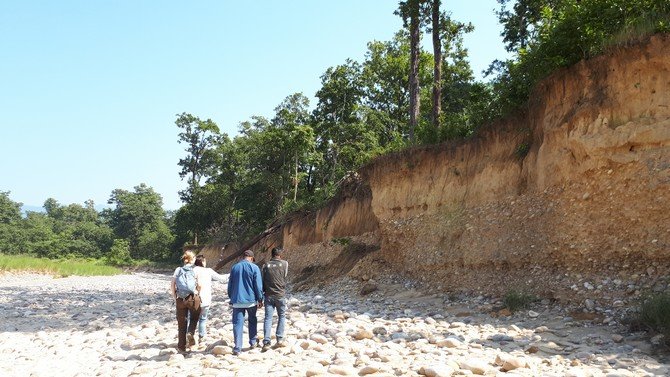
We study the historical grassland dynamics in the forests and floodplains of the Bardia district in Nepal, and quantify the influence of climate change and human interventions on the landscape. We assess the relationships between river dynamics, groundwater, landcover, land-use, and grazing ungulates through fundamental, multi-disciplinary research. Strategies for sustainable land management and tiger habitat conservation are developed together with the local community. Concurrently, public awareness is raised at local to global scale to stimulate conservation of the tiger habitat.
There are less than 6000 wild tigers alive, and although numbers are increasing, their habitats are under pressure due to climate change and anthropogenic activities. The Terai Arc Landscape (TAL) and the Duars at the foot of the Nepalese, Indian and Bhutanese Himalayas are the most important conservation area of tigers. Here, tiger habitats are affected through changing hydrological conditions that lead to deteriorating grasslands upon which free roaming deer rely for grazing. However, the natural and anthropogenic influences on grassland dynamics in these landscapes are poorly understood. Therefore, the overarching objective of this project is to characterize the temporal dynamics of the grasslands in the 23 nature reserves present. Particularly, the hydrology and river morphodynamics as abiotic factors become addressed as well as the pressures behind these two. This is not only a scientific, ecohydrological novelty but also crucial in combining preservation of the tiger habitat with sustainable water resources management in the TAL, the Duars and upstream Himalayas.
Within the larger project frame work, the research conducted at the Soil geography and Landscape group focusses on providing data on past states of the landscape in and around Bardia district on a Holocene time scale. We aim to reconstruct the past activity of river channels, by dating the deposition of sediments on which the district lies, while also discovering when channels stopped being active. Alongside river channel activity, we will reconstruct past land use, vegetation and animal activity using a wide range of paleoecological proxies retrieved from lake sediments. By combining these changes in landscape use and composition with findings on transitions in river channel activity, benchmarks of past states of the area can be developed to guide decisions on how the landscape could/should be managed to optimally maintain a sustainable habitat for the tiger, that is in balance with the local communities.
