Equipment
Unmanned Aerial Vehicle for Laser Scanning (LiDAR UAV)
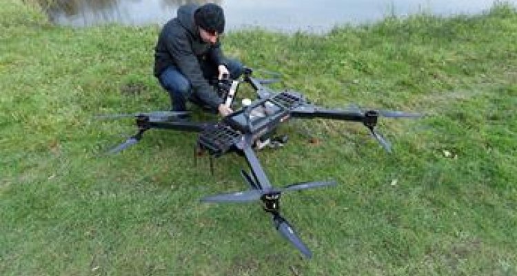
Over the past decade the use of drones or Unmanned Aerial Vehicles (UAV) as a flexible sensor platform for agro-environmental mapping and monitoring has evolved rapidly. Initially from a research perspective but increasingly commercial UAV applications are starting to be developed for operational use. Recently, Laser Scanner systems known as the Light Detection And Ranging (LiDAR) technique have also become available for UAVs. The Shared Research Facilities of Wageningen University and Research has acquired the Riegl RiCopter Unmanned Laser Scanning System.
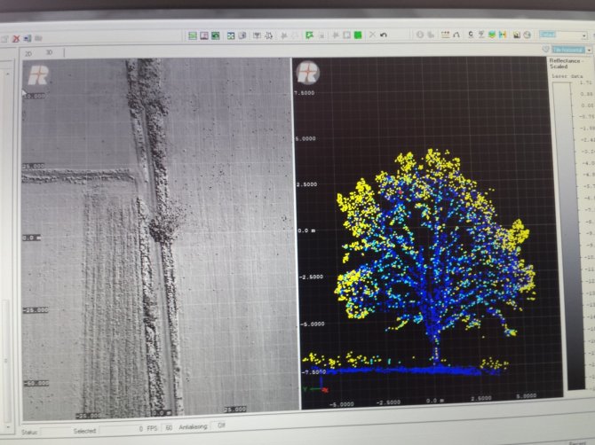
From this LiDAR system, detailed and precise 3D models of objects can be collected and mapped: e.g., plants, trees, buildings, infrastructure such as dikes, and the ground surface.
Light Detection And Ranging (LiDAR) works by sending laser pulses into an array of accurately defined directions in fast succession. Measuring the travel time it takes for each laser-pulse to be reflected from the targets and returned to the LiDAR-scanner allows reconstruction of distances and directions of surfaces surrounding the scanner. Attaching a LiDAR scanner to a moving platform like a UAV allows 3D mapping of larger surface areas as the UAV platform is moving ahead.
The acquired Unmanned Laser Scanning datasets can either be provided as raw datasets or as processed end-product (3D point cloud x,y,z data, and gridded surface models). The delivery format and processing level will be agreed on with the user of the instrument. For all flight operations of the Laser Scanning UAV can a certified pilot and a trained operator are required.
Technical details

The components of the Unmanned Laser Scanning system can be summarized as follows:
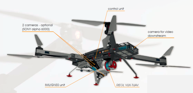
- RIEGL RiCOPTER remotely piloted aircraft system equipped with RIEGL VUX-SYS complete miniaturized, lightweight ALS System
- RIEGL VUX-1UAV lightweight airborne laser scanner fully integrated, providing 230° FOV, an effective measurement rate up to 350,000 meas./sec, and 10 mm accuracy
- fibre-optic gyroscope and GPS/GLOSNASS receiver integrated
- compact control unit with various interfacing options
- mounting options for highly flexible aircraft installation
- prepared for remote control via low-bandwidth data link
- operates up to 2 digital cameras
Riegl RiCopter Aircraft technical data
| Main dimenisions (ready to fly) | 1920mm x 1820mm x 470mm |
| MTOM (maximum take-off mass) | < 25 kg |
| Maximum payload (batteries and sensor load) | up to 16 kg |
| Empty weight | 8 kg |
| Maximum flight endurance | with 8 kg sensor load: up to 30 min |
| Cruise speed | typical 20-30 km/h |
| Take-off / Landing | Vertical Take-off and Landing |
Riegl VUX-SYS Sensor system technical data
| System components | Riegl VUX-1UAV LiDAR sensor, IMU/GNSS unit with antenna, control unit, up to 2 cameras |
| Field of View (FOV) | 230° |
| Max. effective measurement rate | up to 350,000 meas/sec |
| Max. range @ target reflectivity 20% | 550 m |
| Minimum range | 3 m |
| Range accuracy | 10 mm |
| Laser Safety Class | Laser Class 1 (eye safe) |
| Accuracy Roll, Pitch / Heading | 0.015° / 0.035° |
| IMU sampling rate | 200 Hz |
| Position accuracy (typ.) | 0.05 m – 0.3 m |
| Type | Sony alpha 6000 |
| Interfaces | 2x trigger and event marker |
Applications
The UAV Laser Scanning system allows the creation of diverse datasets, ranging from basics like point cloud data (LAS format) and high-resolution RGB imagery, to more advanced products like Crop Height Models (CHM), point density distribution maps and forestry parameters.
Applications include mapping the structure of crops (phenotyping and precision agriculture), trees (orchards and forestry), and infrastructure (construction and safety but also can be extended to terrain mapping for applications like archaeology and coastal management. In addition, other applications can be brought in and discussed.
Complementary techniques
Publications
-
A lightweight hyperspectral mapping system and photogrammetric processing chain for unmanned aerial vehicles
Remote Sensing (2014), Volume: 6, Issue: 11 - ISSN 2072-4292 - p. 11013-11030. -
Forest inventory with terrestrial LiDAR : A comparison of static and hand-held mobile laser scanning
Forests (2016), Volume: 7, Issue: 6 - ISSN 1999-4907 -
Nondestructive estimates of above-ground biomass using terrestrial laser scanning
Methods in Ecology and Evolution (2015), Volume: 6, Issue: 2 - ISSN 2041-210X - p. 198-208.
