
News
Mapping out climate change
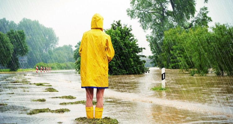
How do you get people to really understand how urgent the climate crisis is? By literally putting the impact of climate change on the map! That is exactly what researchers from WUR and others have done.
The Climate Impact Atlas is a free online tool that shows, on maps, which parts of the Netherlands are at risk of flooding or where the most heat is expected to occur.
The Climate Impact Atlas shows that the consequences of climate change are significant and that adapting to them must be a top priority for our country.
The Climate Impact Atlas helps you to get a first impression of these effects of climate change in your own environment. By looking at the map, you undoubtedly feel the problem more than before. You really get the picture.
The map also helps water boards, municipalities, provinces and central government to understand the risks and possible scenarios and to use these to make policy to prevent major problems.
Are you up to the challenge?
Do you want to contribute to the understanding of climate problems and to possible solution strategies? Then these courses are right up your alley:
- Bachelor Communicatie en Life Sciences
- Bachelor Environmental Sciences (milieukunde)
- Master Environmental Sciences (milieukunde)
- Bachelor International Land and Water management
- Master International Land and Water Management
- Bachelor Soil, Water, Atmosphere
- Master Aquaculture and Marine Resource Management
- Master Climate Studies
- Master Earth and Environment
- Master Urban Environmental Management
Already finished a study? Then take a look at our vacancies.
About the Climate Impact Atlas
Over ten years ago, Wageningen University & Research took the initiative for the Climate Impact Atlas at the request of the provinces. It has since grown into a collaborative project involving KNMI, Deltares, Rijkswaterstaat, the Delta Programme, Amsterdam University of Applied Sciences and other partners. The Climate Adaptation Services Foundation (CAS) manages the Climate Impact Atlas and ensures that the information remains up to date.