Student testimonial
Student Jasper - MSc Geo-information Science
Hi there! In this little piece, I will provide you with some insights into the master Geo-Information Science (MGI) and my personal enthusiasm regarding this master program. Hopefully, it will give you a better idea of what the program entails and will it make your choice a little bit easier. Before delving into the master itself, I will introduce myself shortly. My name is Jasper, I am 23 years old and almost done with the first year of the master.
remote sensing can also be a great asset for studying cultural, economic or social issues
Before starting the Geo-Information Science master in 2020, I did the liberal arts and sciences program at Leiden University College located in The Hague. During this bachelor, I followed the major “Earth, Energy and Sustainability” where I primarily focused on the energy transition, ecological systems and, more generally, the impacts humans have on the environment. This being a rather broad program, I experienced much freedom to follow courses in other areas such as political economy, governance and economics. This also allowed me to come in contact with the field of GIS with an introductory GIS course, followed by an advanced GIS course. Here, I learned the basics of remote sensing and spatial analyses, but, more importantly, I was introduced to the incredible wealth and potential of spatial data. Where this bachelor really helped me to think across academic fields, I was also educated rather broadly and sometimes missed a specific focus to develop hard skills. The GIS master definitely does have this focus with a strong focus on developing hard skills such as programming.
Experiences
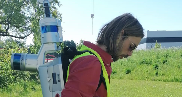
The GIS master can be seen as a combination between data science, geography and statistics. Nowadays, there is a relatively strong emphasis on the data science and statistics part, meaning that there is quite some scripting involved. I personally was familiar with R prior to starting MGI, but I had no experience with other languages nor had ever applied scripting to spatial data. However, during the intensive python and geo-scripting courses, I was amazed at how quickly you can pick up on these skills. For this geo-scripting course, we built a web application displaying the expansion of a refugee camp in southern Bangladesh using satellite data. This project showed me the wide applications for which remote sensing can be used. It is often associated with environmental applications, but remote sensing can also be a great asset for studying cultural, economic or social issues such a refugee displacement. This means that you are not bound to one specific career sector and that you can easily shift between sectors depending on your interest and passions. This freedom I personally really enjoy. This wide variation also exists in the data sources which range from optical to radar to LiDAR data. Currently, for my thesis I am working with high-resolution (1-2cm) drone data in combination with machine learning algorithms to study individual plant and tree growth throughout the season. I find this topic very interesting as it combines high-quality data, data analysis and fieldwork to achieve very tangible and real results.
Future steps
During the last year I developed a lot on my remote sensing knowledge and scripting skills making me feel considerably more prepared to start my working career than before the MGI master. The coming year I will spend writing my thesis, doing an internship and perhaps follow some more courses. I would like to delph more into deep learning as well, as there are huge developments going on in that area. For my internship I would like to go abroad to an NGO like the Food and Agricultural Organization (FAO) where remote sensing is applied to achieve higher food security across the globe. This has been an interest to me for a long time, as I think that remote sensing plays an important role in ensuring stable food production globally especially with a rapidly changing climate. At the same time, new and interesting remote sensing companies arise quickly which also offer many fascinating projects. I do know that I would love to explore the possibilities of working abroad and apply remote sensing to cases where I can actually do some good. Where and what this will be exactly is something that I will find out along the way.