Thesis subject
MSc thesis topic: Using high-resolution satellite imagery and deep learning to map artisanal mining footprint in DRC
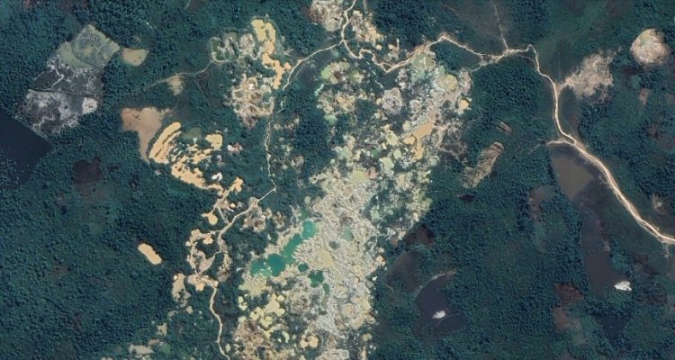
Artisanal or small scale mining (ASM) is an important source of livelihoods for a significant population in the Democratic republic of Congo (DRC) but it can bring with it many problems, including deforestation, conflict, displacement, water pollution and child labor [1]. Timely detection and monitoring of ASM is crucial to ensure that it can take place without compromising forest resources and supporting sustainable development. The ASM are informal thus pose challenges related to detection, documentation and reporting of their locations which useful for management, and policy decisions by government [2]. Satellite images have been used to map ASM, either through visual interpretation of high resolution images or machine learning. However, limited spatial resolution, canopy cover, and cloud cover presents challenges to accurately detect ASM in forest areas and over large extent [3,4].
The recent advance and availability of earth observation data and deep learning technologies provide an opportunity to monitor the earth in high detail and all weather. In this thesis you will use high resolution Planet-NICFI images, Sentinel-1 radar data and satellite alerts (Hansen forest loss and RADD alerts) [5,6] to detect and map ASM in DRC using a deep convolutional neural network model.
Software: Tensorflow, Pytorch (python) and Google Earth Engine
Objectives
- Literature on artisanal mining in DRC
- Train and test a deep learning model for mapping artisanal mining in DRC
- Generate a map of artisanal mining in DRC
- Perform accuracy assessment on the generated map
Literature
- Geenen., et al. " A dangerous bet: The challenges of formalizing artisanal mining in the Democratic Republic of Congo” (2012).
- Gallwey, et al. "A Sentinel-2 based multispectral convolutional neural network for detecting artisanal small-scale mining in Ghana: Applying deep learning to shallow mining” (2020).
- Barenblitt, et al. "The large footprint of small-scale artisanal gold mining in Ghana” (2021).
- Tang, et al. "Global mining footprint mapped from high-resolution satellite imagery” (2023).
- Reiche, et al. "Forest disturbance alerts for the Congo Basin using Sentinel-1” (2021).
- Reiche, et al. "High-resolution global maps of 21st-century forest cover change” (2013).
Requirements
- Advanced Earth Observation course
- Machine learning course
- Geo-scripting course (Good knowledge in scripting is an asset; e.g. python, Google Earth Engine, and java script)
Theme(s): Sensing & measuring; Modelling & visualisation