Thesis subject
MSc thesis topic: How well can we update land cover fraction maps?
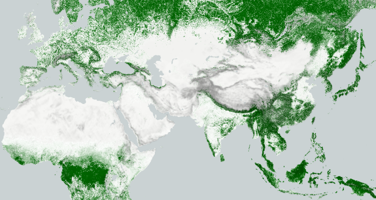
Land cover fractions are a new way to represent land cover. Each fraction is an indication of how much area of the pixel is occupied by that land cover class. This innovation enables an exciting prospect of tracking gradual change trends in every type of land cover over time globally – but how feasible is it?
In 2019, the Copernicus Global Land Services for the first time released a global map of 10 land cover fractions for the year 2015. In 2020, the map was updated yearly until 2019, allowing us for the first time ever to get a glimpse of trends over time in every land cover class in every location of the world. This is a breakthrough for many fields: forest degradation monitoring, climate change and urban sprawl modelling, and even for looking after your own back yard.
However, this map was a pioneering effort, and so far it is unknown how well gradual changes can be represented using land cover fractions. A small fluctuation in the input parameters may cause the predicted fraction to change wildly, causing an overestimation of change. More research is needed to both establish what trends we can see from the existing maps, how reliable they are and how to represent them, as well as to investigate ways of minimising the amount of reported false change. This is key for reliable climate modelling and accurate global change trend estimation.
In this thesis, you will have a lot of choice and potential for customisation. You can either work with the existing map, or with make your own land cover fraction maps. You can also choose your class of interest. You will then analyse the change in trends and you can choose which techniques to apply to try and make them more robust, for example deep learning techniques such as Markov Random Fields/Markov Hidden Model. Finally, you can investigate how to visualise the resulting trends, using techniques such as RGB or change vector maps, and compare which ones convey the message the best.
Relevance
This research links to the wider research done in the Copernicus Global Land Services: Land Cover 100 m (CGLS-LC100) project at GRS and VITO.
Objectives
- Analyse trends in land cover fraction maps
- Investigate post-processing techniques to make trends more robust
- Compare ways to visualise the change in land cover fraction trends
Literature
- Hengl, T., Walvoort, D. J. J., Brown, A., & Rossiter, D. G. (2004). A double continuous approach to visualization and analysis of categorical maps. International Journal of Geographical Information Science, 18(2), 183–202.
- Ahmed, B., Ahmed, R., & Zhu, X. (2013). Evaluation of Model Validation Techniques in Land Cover Dynamics. ISPRS International Journal of Geo-Information, 2(3), 577–597.
- Leinenkugel, P., Wolters, M. L., Kuenzer, C., Oppelt, N., & Dech, S. (2014). Sensitivity analysis for predicting continuous fields of tree-cover and fractional land-cover distributions in cloud-prone areas. International Journal of Remote Sensing, 35(8), 2799–2821.
Requirements
- Geoscripting
Theme(s): Modelling & visualisation; Integrated Land Monitoring