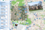
Map Table
In many multi- and transdisciplinary studies the role of maps as medium to communicate and participate is of great importance. The exchange of information by maps ranges from mass media by newspapers, television and websites to very individual by sketch paper and tablet.
The exchange of information by maps in small groups (2 up to 6 persons) can be supported more efficiently and effectively supported by the use of Map Tables.
Objectives related to the use of a Map Table:
- to promote participation of different stakeholders by using more interactively geo-information
- to study stakeholder geo-information by monitoring the map table use
- to improve usability of map table interfaces in favour of participative projects
- to detect and overcome knowledge gaps between different stakeholders
Education
The Map Table can be used for group work during courses. Lecturers and students currently have no support.
Research
The Map Table is a very versatile tool during small group brainstorm and evaluation sessions (eg in participatory planning) and in specific usability studies.
Equipment
Samsung SUR40 pixelsense technology
- Software:
MS-Windows
MS-Surface - Application examples
(GLEE, Phoenix, Climate Atlas)
In collaboration with
- Alterra | Earth observation and environmental informatics
- Alterra | Climate change and adaptive land and water management
- Onwijs
